
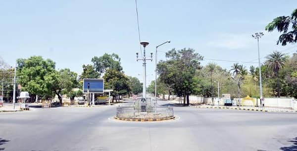
Ramaswamy Circle Mysuru is not simply a traffic junction. It is a memorial. The circle connects Chamaraja Double Road and JLB Road (Jhansi Lakshmi Bai Road) in one of the city’s most historically significant institutional zones, PIN code 570005, with Mysore University as the post office zone. But its name carries a specific weight that most circles in this series do not: Ramaswamy Circle is named after a schoolboy from Banavara who was killed by police fire at this very spot on 13 September 1947, during the Mysuru Chalo movement — a popular agitation demanding the integration of the princely state of Mysore into independent India. He was not a seasoned political leader. He was a student, arrested and imprisoned five times for his activism while still in school.
Who Ramaswamy Was
Born in 1919 in Banavara village in Mysore district, Ramaswamy grew up in a family his father Anantharamaiah watched commit to the freedom struggle while still a child. His wife Lalithamma was equally dedicated — together they picketed in front of cloth shops, participated in the Badanavalu and Hamilton Building Satyagrahas, were arrested and imprisoned with their child for their activism. Ramaswamy was arrested five times. He organised and participated in processions against colonial and autocratic rule. On 13 September 1947 — after independence had been declared nationally but before Mysore’s formal integration — police fired on demonstrators during the Mysuru Chalo movement near the junction now bearing his name. Ramaswamy of Banavara, Thoranayaka of Kadakola, and a third young man named Ranga were among those killed.
The junction carries his name so that Mysuru does not quietly forget this. The Star of Mysore reports that on the 75th anniversary of his death in 2022, the Chamaraja MLA said he intended to “create awareness about the sacrifice made” by these young men — an acknowledgment that the circle’s naming is a deliberate act of civic memory rather than mere administrative labelling.
Location and the Institutional Cluster
Ramaswamy Circle connects Chamaraja Double Road and JLB Road — two of Mysuru’s most institutionally significant arterials — at coordinates approximately 12°18’N, 76°38’E. The surrounding zone is a remarkable concentration of Karnataka’s educational and governance heritage.
Hardwicke High School and College is 280 metres south of the circle — the school mentioned in oral accounts of the 1946 freedom movement where students marched shouting Bharat Mata ki Jai and Vande Mataram. Maharaja College Centenary Hall (the theatre building) is near the circle. Yuvarajas College is in the zone. University of Mysore’s main campus and Crawford Hall on the Krishnaraja Boulevard are reachable from the circle’s road network — and the post office designation (Mysore University) confirms the institutional geography. Jagan Mohan Palace Grounds, Vaani Vilas Mohulla, Maharani’s High School, and the University Athletic Ground are all mapped as adjacent landmarks on Wikimapia.
Mysore Palace — Amba Vilas Palace, one of India’s most visited monuments and the official residence of the Wadiyar dynasty — is approximately 1.5 km east of Ramaswamy Circle. Chamarajapuram Railway Station on the Mysore–Chamarajanagar branch line is approximately 730 metres southwest.
The Dasara and Cultural Identity
Mysuru’s Dasara festival — one of the most celebrated festivals in Karnataka, with a royal tradition going back to the Vijayanagara Empire — brings the Ramaswamy Circle zone into the heart of the celebration. The Star of Mysore reports that ahead of Dasara, fibre replicas of four elephant heads were installed at Ramaswamy Circle as part of the city’s beautification programme — inspired by the iconic elephant heads statue at Highway Circle. The circle’s position in the institutional-heritage belt of Mysuru makes it a natural focal point for civic beautification during the festival season.
Daily Life and Commercial Character
Shoe World, established in 1998 at Ramaswamy Circle on 100 Feet Road, is one of the circle’s most cited commercial landmarks — a long-standing footwear retailer that opened a second outlet in the city. Preety Cancer Hospital is near the circle. BJP city workers have used the circle for political protests, and Yuva Bharat holds its annual September commemoration here. The circle functions as a daily navigation reference, protest venue, festival display site, and quiet memorial simultaneously — the layered function of a genuinely old Indian city junction.
FAQs About Ramaswamy Circle Mysuru
Q: Who was Ramaswamy and why is this circle named after him?
A: Banavara Ramaswamy was a freedom fighter and student who was killed by police fire at this junction on 13 September 1947 during the Mysuru Chalo movement — a popular agitation for Mysore’s integration into India. He had been arrested five times for his activism. The circle is named in his memory alongside Thoranayaka of Kadakola and Ranga, who also died that day.
Q: Which roads meet at Ramaswamy Circle Mysuru?
A: Chamaraja Double Road and JLB Road (Jhansi Lakshmi Bai Road, which runs along the University of Mysore campus). PIN code 570005, Mysore University post office.
Q: How far is Mysore Palace from Ramaswamy Circle?
A: Approximately 1.5 km east — accessible in minutes by auto-rickshaw through the central Mysuru street network.
Q: Which railway station is nearest to Ramaswamy Circle?
A: Chamarajapuram Railway Station on the Mysore–Chamarajanagar branch line is approximately 730 metres southwest of the circle.
Q: What educational institutions are near Ramaswamy Circle?
A: Hardwicke High School and College (280 metres south), Maharaja College Centenary Hall, Yuvarajas College, and the University of Mysore campus on the Krishnaraja Boulevard are all in the immediate zone.