
Nanjappa Circle Bengaluru sits at Vidyaranyapura Main Road, GD Layout, Doddabommasandra, Vidyaranyapura, Bengaluru, Karnataka 560097, with Vidyaranyapura as the post office. The circle marks the primary road junction of the Nanjappa Layout-Vidyaranyapura zone in northern Bengaluru — at the intersection of Vidyaranyapura Main Road and Nanjappa Thindlu Road, with Nagaland Circle as the adjacent junction less than 100 metres away. It falls under the Dodda Bommasandra Ward, Byatarayanapura Assembly Constituency, represented by MLA Krishna Byregowda, within Bangalore North Lok Sabha constituency with MP DV Sadananda Gowda. Elevation is 874 metres.
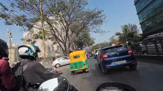
Location in the Vidyaranyapura-BEL Belt
Nanjappa Circle’s geography is defined by the institutions and industrial infrastructure that fill north Bengaluru’s residential belt. Bharat Electronics Limited (BEL) — one of India’s largest defence and aerospace electronics manufacturers, under the Ministry of Defence — has its sprawling campus in the immediate area. BEL Layout 1st Block and 2nd Block are named residential zones derived directly from BEL’s employee housing, giving the entire Nanjappa Circle-Vidyaranyapura zone its foundational residential identity. HMT (Hindustan Machine Tools) is approximately 0.7 km from the BEL zone — another central government manufacturing giant whose operations and employee colonies shaped north Bengaluru’s residential geography in the 1960s–80s.
The University of Agricultural Sciences Bengaluru — GKVK Campus — is visible in the broader Nanjappa Circle zone. Jalahalli, Doddabommasandra Lake, Ananda Ashrama, and Sri Chaitanya Techno School are additional landmarks placing the circle within north Bengaluru’s institutional-residential character.
BMTC Routes and Transport Connectivity
Nanjappa Circle Bus Stop on Vidyaranyapura Main Road is a named BMTC stop. Routes serving the junction include 288E (Shivaji Nagar to Vidyaranyapura Main Road), 276H, 401-B (Yelahanka to Hampinagara), 401-BB, 401-E, and multiple Yelahanka corridor variants. Nanjappa Thindlu Road branches off from the circle, providing a secondary arterial connector to the Thindlu-Yelahanka corridor.
Kodigehalli Railway Station is approximately 3 km from the Nanjappa Layout-Vidyaranyapura zone — the nearest suburban rail access on the South Western Railway network. Lotte Golla Halli Railway Station is an alternative. Goraguntepalya Metro Station on the Green Line is approximately 6 km away via NH-75. Peenya Metro Station is approximately 8 km. Kempegowda International Airport is approximately 23 km — one of the closer residential zones to the airport within the broader Bengaluru urban area.
The Employment Base — Industrial Bengaluru’s Residential Shadow
The Nanjappa Circle zone’s housing demand is entirely explained by the employment belt it serves. Yeswanthpur Industrial Area is 6–8 km, Peenya Industrial Area 8–10 km, and Rajaji Nagar Industrial Town 10–11 km. Brigade Rubix, Kirloskar Business Park, and Embassy Manyata Business Park are 5–10 km away. This means the zone is simultaneously accessible to old-economy industrial employment (BEL, HMT, Peenya industries) and newer commercial and tech employment (Manyata Tech Park, Kirloskar). The dual employment base sustains rental demand across income segments.
BEL Road and Vidyaranyapura Main Road are described as the “primary lifelines” of the zone — with local vegetable markets, Reliance Smart Point outlets, Apollo Pharmacy, and MedPlus serving daily needs. Zee School Vidyaranyapura and RR High School are cited for education. Jalahalli Metro Station on the Green Line is reachable via Jalahalli Cross or Peenya, connecting to central hubs like Majestic.
The Civic Notes
Hard water is a documented problem in the Nanjappa Layout zone — high TDS, hair and skin issues, and tanker dependency during peak summer. Bore well dependence in older buildings with limited Cauvery coverage. Power cuts are not daily but occur during monsoon or maintenance periods. Peak-hour traffic on Tumkur Road and BEL Road near junctions creates congestion. These are typical north Bengaluru residential zone trade-offs — functional infrastructure with the limitations of age and organic growth.
FAQs About Nanjappa Circle Bengaluru
Q1. What is the pincode of Nanjappa Circle Bengaluru?
PIN code 560097, with Vidyaranyapura as the post office. The circle is in the Nanjappa Layout, Vidyaranyapura zone of north Bengaluru.
Q2. Which ward and constituency covers Nanjappa Circle?
Dodda Bommasandra Ward, under the Byatarayanapura Assembly Constituency (MLA: Krishna Byregowda) and Bangalore North Lok Sabha constituency (MP: DV Sadananda Gowda).
Q3. Which metro station is nearest to Nanjappa Circle Bengaluru?
Goraguntepalya Metro Station on the Green Line is approximately 6 km away via NH-75. Peenya Metro Station is approximately 8 km. Both require a feeder auto or BMTC from the circle.
Q4. Why does the Nanjappa Layout zone have strong rental demand?
Its proximity to BEL (Bharat Electronics Limited), HMT, Peenya Industrial Area, and the Manyata Tech Park-Kirloskar Business Park commercial corridor creates sustained demand from industrial workers, defence sector employees, and commercial professionals across income segments.
Q5. Which railway station serves Nanjappa Circle Bengaluru?
Kodigehalli Railway Station is approximately 3 km away. Lotte Golla Halli Railway Station is an alternative. Both are on the South Western Railway network.